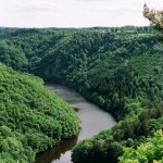
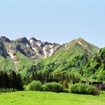
 The nickname « France’s Water Tower » could be given to the whole Massif Central (region in South-central France, consisting of mountains and plateaux), but is rather given to Auvergne. Why?
The name « France’s water tower » actually takes several aspects into consideration: the hydrological patrimony, the amount of precipitation and the number of natural springs in the region. Although water is very present in Auvergne, it is not distributed equally across the region.
Auvergne has a dense branched hydrographical network. Permanent water courses nearly cover 23,000 km (i.e. about 14,300 miles), if we add the temporary water courses they cover 38,000 km (i.e. about 23,600 miles). The following rivers run through the region: the Loire, the Allier River, the Cher River, the Dordogne (which rises on the flanks of Puy de Sancy) and the Lot.
We count 109 mineral water springs in Auvergne (out of a total of 626 springs in France), 10 spa towns (out of 105) and 10 water bottling factories (out of 70 mineral bottled waters in France).
Averaged-annual preicipitation is 920 millimeters. However, the weather conditions vary from place to place. On the west side of the Cantal Mountains, the precipitation is 2000 millimeters. But on the other side of the Lioran-pass, the city of Murat receives 970 mm annual precipitation. The Auvergne’s central and east plains have the continental climate with less than 800 mm precipitation a year.
 If you go hiking in the Cantal Mountains, you will realise it sometimes rains a lot in Auvergne. I can still recall trails turning into real rivers there. However, Clermont-Ferrand is a rather dry city and you are often told it doesn’t rain enough there.
So, if you spend your holidays in Auvergne and that you think it’s too rainy, all you have to do is cross a pass or cross over to another valley to enjoy a milder microclimate.
Sources (French) :
- Chambre régionale d’agriculture d’Auvergne
- Direction régionale de l’environnement d’Auvergne
- Direction départementale de l’équipement et de l’agriculture du Cantal
- Météo France, accès aux bulletins climatiques

