 The Massif du Sancy is a volcanic mountain mass located in the Massif Central, in the middle of Auvergne, more precisely in the Puy de Dôme department, by thirty kilometres at the South of Clermont-Ferrand. Water there is everywhere, whatever the mountainside is: you cannot miss it.
Waterfalls, springs and watercourses, even peat bogs: water is omnipresent. Thus the following question: why does the Massif du Sancy enjoy such a hydrography?
Back to the French version
Here is a little article that claims to give answers, but also to explain the Massif du Sancy’s geography by dwelling on the famous Vallée de Chaudefour, and the less known Vallée de la Fontaine Salée.
The Massif du Sancy was a volcanic mountain mass active until 220 000 years BC. Its highest peak is called the Puy de Sancy, which is also the highest volcano in continental France. It is 1886 meters tall, but probably reached 2500 meters in the past. This volcano is the starting point of many crests and the valleys lay around it. What the Sancy’s geography and hydrography are due to?
The collapse of the mountainsides in the form of stone avalanches is the most convincing reason to explain why the water is now free and carries the Sancy’s volcanic character. It is filled with minerals (above all iron), and also gaz. Hence the many (countless?) watercourses that rise on the mountainsides and the peat bogs that are impossible to miss.
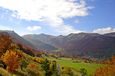
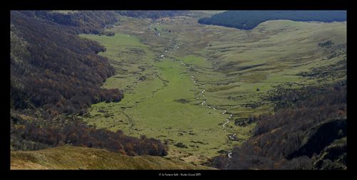
The Massif’s layout is also due to the melting down of the glaciers, which carved the valleys that lay below. There is a total of 4 valleys: the renowned Vallée de Chaudefour (also Nature reserve), the Vallée de la Dordogne (where the Dore and the Dogne rise, as its name suggests), the Vallée de la Fontaine Salée (Nature reserve to-be), and the Vallée de la Biche.

Here is a map by the French National Geographic Institute to show the aspect of the Massif and its water system
Let’s deal with the 2 valleys mentioned in the beginning of the article.
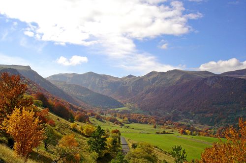
The most famous and symbolic valley in the Sancy is the Vallée de Chaudefour. It is an ice valley that stretches over 900 hectares from 1150 to 1854 meters high. 5 springs spurt out of its particularly steep slopes. They are called “n°1”, “n°2”, “Vercingétorix”, “Petit Griffon” and “Source Sainte-Anne”, the most famous. Its ochre colour is explained by the fact that water is filled with iron (as well as carbonic acid, calcium and magnesium).
 I tasted it so I may confirm that acidity and iron are strong. It is not necessarily nice… but it wouldn’t be fair to refuse to taste. Any accomplished visitor has to do so!
Anyway, as I was saying, the “Source Sainte-Anne” is a mineral water, so it has thermal and curative virtues. Thus it is used to treat diseases: stomach diseases for instance.
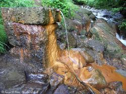
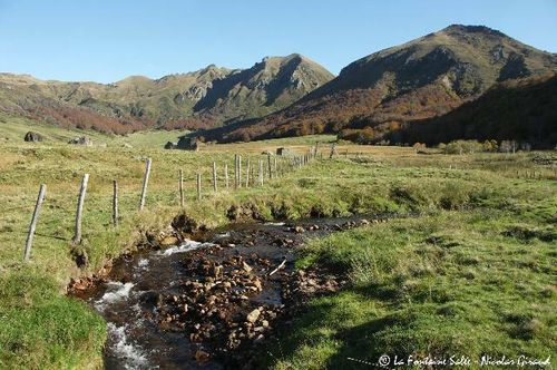
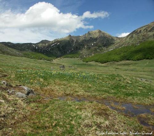
The Vallée de la Fontaine Salée is actually a cirque built by the melting down of the glaciers (that is why you can find rocks here and there). Lots and lots of watercourses of sparkling water, full of iron and minerals, flow along the valley. Thus the name comes from those numerous salted springs.
La Fontaine Salée by Nicolas Giraud - http://www.nicolasgiraudphoto.com/
La Fontaine Salée by Nicolas Giraud - http://www.nicolasgiraudphoto.com/
As you will be pacing these valleys up and down, you will find peat bogs. To form, it needs considerable rains, water that stagnates and vegetation to impede its correct drainage. They are shelters for fragile ecosystems thanks to flora like moss and sundews. Peat bogs have received the unambiguous nickname “mountain quicksand”. That is why it is recommended to avoid set your foot in, or else you would do some efforts to get out of those marshy lands.
La Fontaine Salée by Nicolas Giraud - http://www.nicolasgiraudphoto.com/
As a conclusion, the Massif du Sancy enjoys geology and climate that have a salutary influence on its hydrography. This combination offers us such a sight. Nature does work wonders.
Back to the French version